gate 3:
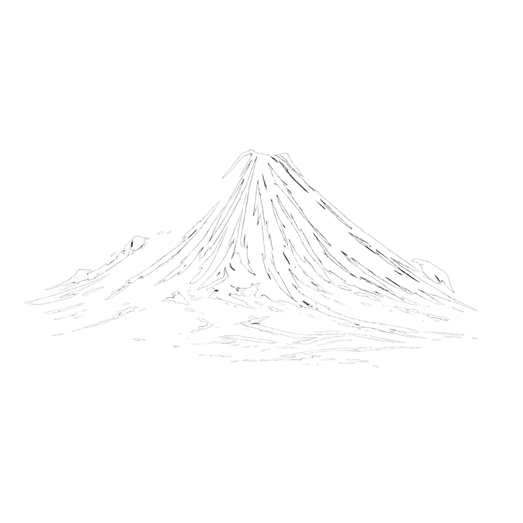
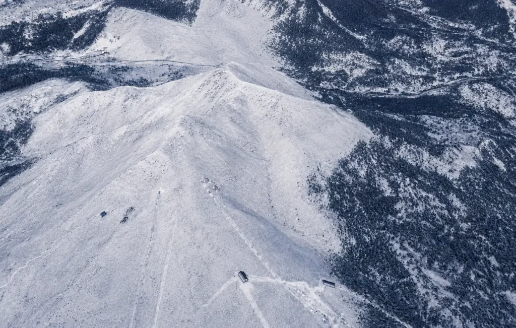
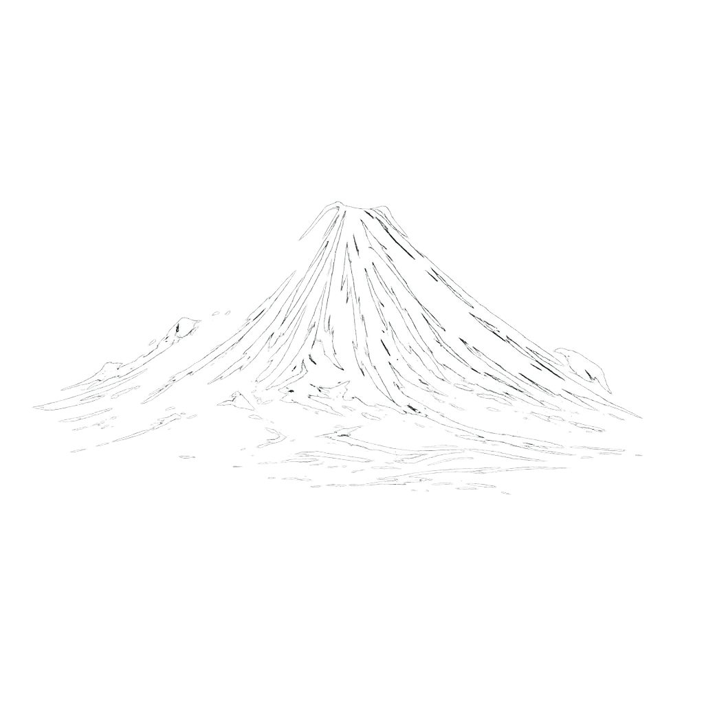
hirafu peak
ADVANCED TO EXPERT
Known as one of Niseko’s most iconic gates, it offers sustained steep terrain, wind-shaped features, and consistently deep powder on storm cycles.
location
Grand Hirafu

aspect
All aspects
angle
30º to 45º
Distance
1,3 / 2,8+ km
Exposure
High
Vertical drop
520 / 840 m
Line options
Multiple lines
gate overview
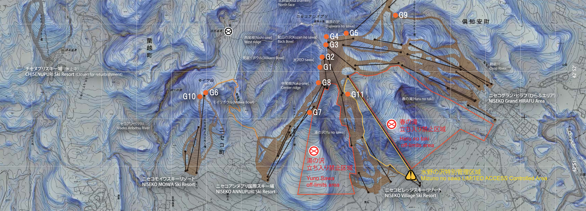
Opens from the summit of Hirafu and provides access to a wide range of freeride lines leading into East Ridge, the North Face, and the Back Bowl. The area is defined by long fall-line descents, wind-loaded terrain, and technical route choices that reward experienced riders during storm conditions.
Terrain features
Steep alpine faces, wind-loaded slopes, narrow chutes, and wide open powder fields. The upper section is fully exposed with no trees, offering clear lines and variable snow textures shaped by wind and temperature changes. Transitions to more sheltered terrain lower down.
Expert tips
Access only in clear weather. The area includes complex terrain with significant wind loading and rapid snowpack changes. Riders should carry full avalanche equipment, understand how to use it, and have a clear plan for their chosen line before entering the zone.
how to get in/out
Accessed by hiking from the top of the King #4 Chairlift to the summit, with descents leading toward the Annupuri base area or traversing and hiking toward the middle or lower Hanazono zones, depending on the chosen line and exit route.
Ride Gate 3 with a local guide
Not sure about conditions, the entry or the best line today? Ride it with someone who knows this gate.
- ✓ Line chosen for the day's snow and avalanche conditions
- ✓ Experienced local guides who know Niseko's gates
- ✓ Private or small groups · skiers and snowboarders
Distance:
1,3 / 2,8+ km
Vertical drop:
520 / 840 m
Exposure:
High
Entry type:
Hike
Exit type:
Skiing / Hike
Line options:
Multiple lines
Ride Gate 3 with a local guide
Not sure about conditions, the entry or the best line today? Ride it with someone who knows this gate.
- ✓ Line chosen for the day's snow and avalanche conditions
- ✓ Experienced local guides who know Niseko's gates
- ✓ Private or small groups · skiers and snowboarders
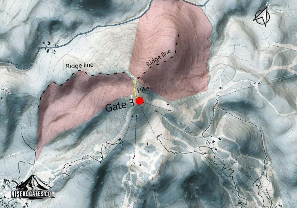
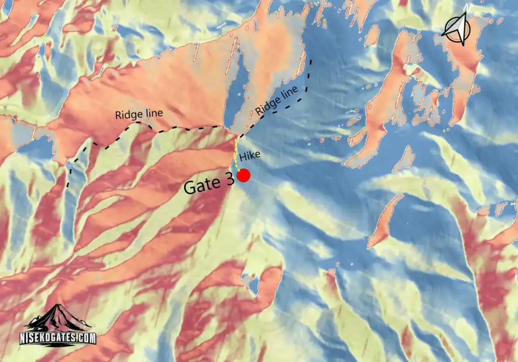
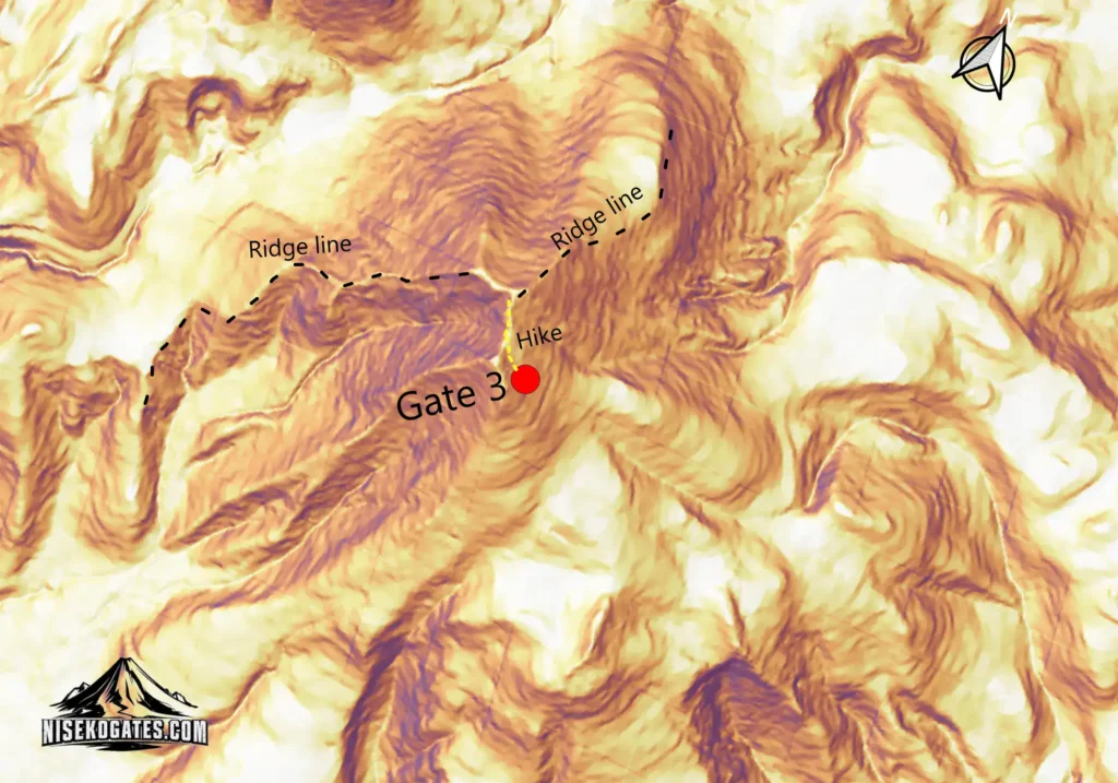
These maps are independently created using topographic datasets, terrain analysis, and GIS tools to help visualize terrain features, access points, and route options around Niseko.
They are intended for reference only and should not replace official avalanche forecasts, navigation tools, or local mountain information.
For professional mapping tools and safety resources, visit the Resources section.
niseko
gates
Independent information for safety backcountry decisions and better days in Niseko.
backcountry gates
Gate 1 – L-GI
Gate 2 – Annupuri Peak
Gate 3 – Hirafu Peak
Gate 4 – Hanazono Ridge
Gate 5 – Hanazono Gate
Gate 6 – Moiwa Peak
Gate 7 – E-Sawa
Gate 8 – Hachi-Ban
Gate 9 – Waterfall
Gate 10 – Moiwa Sidecountry
Gate 11 – Mizuno no Sawa
INSTRUCTION & BOOKING
Private Lessons
Group Lessons
Freeride Foundation
Gate Guiding
Booking Process
legal

need help planning your backcountry trip?
© 2026 NISEKO GATES
Ride smart. Respect the mountains. Share the stoke responsibly. · Lessons in partnership with Limitless Hokkaido.